
NOAA weather products in one place
Wx Bulletin
Made for weather enthusiasts and professionals who want more than a forecast.
- Weather Stories and Area Forecast Discussions from local Weather Forecast Offices
- WPC charts and discussions
- GOES imagery and animation
- No account. No ads. No tracking.
- Coverage across supported U.S. locations
Not designed for severe weather alerts or operational use. Not affiliated with, sponsored by, or endorsed by NOAA, NWS, or any U.S. government agency. Claims no ownership of NOAA/NWS products.
What Wx Bulletin brings together
Pick a location within supported U.S. coverage and go straight to the forecast office, forecast center, imagery, and guidance behind the weather.
Weather Stories and Area Forecast Discussions
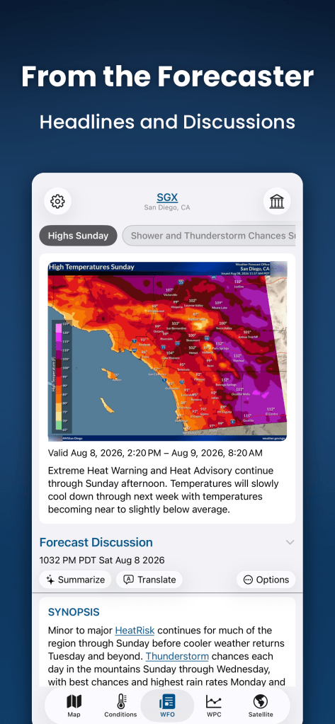
Story Behind the Forecast
See Weather Stories and the latest Area Forecast Discussion from the NWS Weather Forecast Office serving your chosen location. Also view current conditions from a nearby station, hourly and 7-day forecasts, and NWS-style meteograms. Optional AI Summarize and Translate run on device on supported hardware.
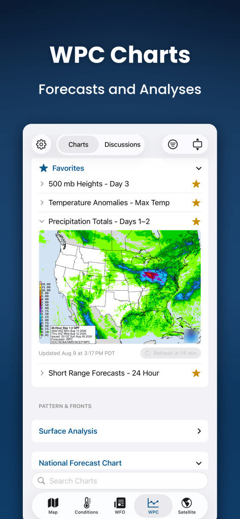
Forecasts, analyses, and national-scale guidance
WPC Charts + Discussions
Browse WPC surface analysis, QPF, excessive-rainfall outlooks, winter-weather guidance, and discussions that explain meteorological reasoning, model and ensemble preferences, and forecast uncertainty. Additional NWS/NCEP products include CPC climate outlooks and NHC tropical products.
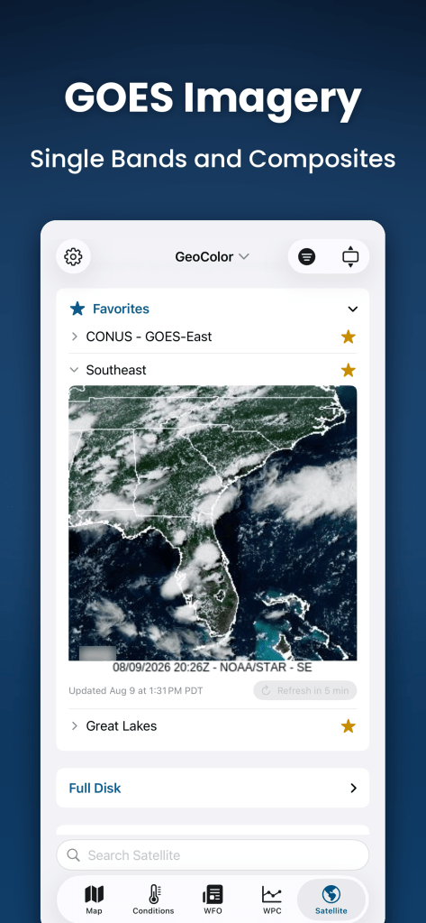
Full Disk, CONUS, sectors, bands, and composites
GOES Satellite Imagery
Explore GOES-East and GOES-West imagery across Full Disk, CONUS, and dozens of regional sectors. Browse all 16 ABI bands and available multispectral composites from NOAA/NESDIS, and animate supported views to follow recent imagery.
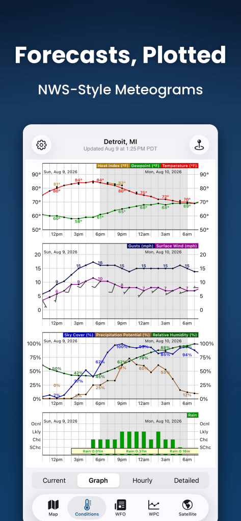
NWS-style meteograms
Forecasts, Plotted
View forecast-grid data as detailed meteograms for temperature, dew point, apparent temperature, wind and gusts, humidity, precipitation probability, sky cover, precipitation amount, and snow amount. Drag from a 7-day view down to 12 hours.
Local conditions, forecast context, and overlays
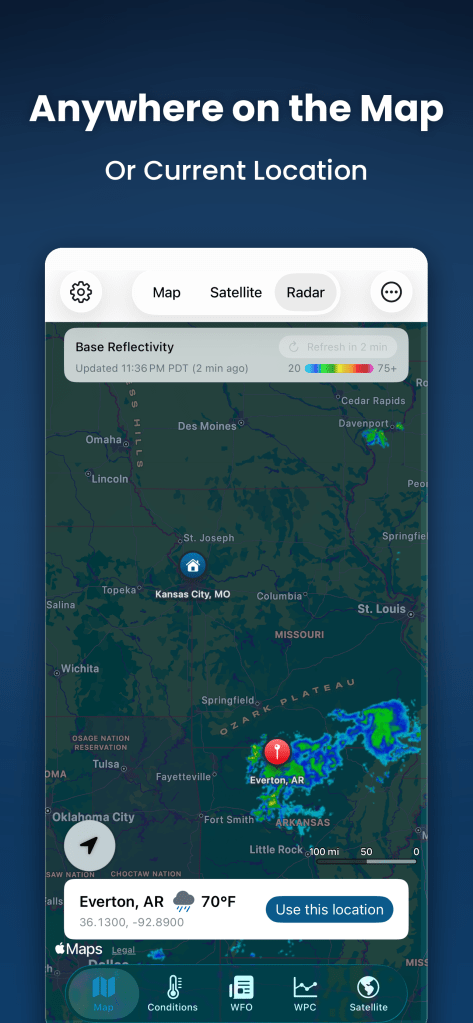
Anywhere on the Map
Tap anywhere in supported U.S. coverage to view local conditions, forecasts, and the responsible Weather Forecast Office. On the map, overlay MRMS reflectivity and WPC Day 1 layers for precipitation, thunderstorms, winter weather, snow, fronts, and pressure centers.
Built for exploration and privacy
- Favorite, reorder, or hide products and sections.
- Open full-resolution charts and imagery; zoom, share, or save.
- Search locations offline using a bundled Census Gazetteer; search text stays on device.
- Review and clear recent locations.
- Use imperial, metric, or both; light, dark, or system appearance; alternate icons; adjustable text size.
- MADIS quality control respected: rejected observations are not shown, and questioned observations are flagged.
Privacy + responsible API use
No account. No ads. No tracking.
Wx Bulletin follows NWS API and source-server caching guidance. The app does not poll weather services on a fixed timer. Cache information and controls are available in Settings.
Wx Bulletin is independently developed and is not affiliated with, sponsored by, or endorsed by NOAA, the National Weather Service, or any U.S. government agency.
Important safety notice
Wx Bulletin is an informational viewer for public weather and forecast products. It is not designed for severe-weather warning, emergency response, storm tracking, navigation, or any other life-safety or operational use.
Wx Bulletin may display NWS alerts, but it is not an alerting service and does not send iOS notifications. Alert availability and timeliness are not guaranteed; data may be delayed, incomplete, unavailable, outdated, or incorrect.
Do not rely on Wx Bulletin as your sole source of hazardous-weather information. For official warnings and emergency guidance, use weather.gov, NOAA Weather Radio, and local emergency management authorities. Do not use Wx Bulletin to operate or support Emergency Alert System encoder/decoder equipment.

